Home

Chandannagar Strand
Chandannagar(Chandernagore or Chandernagar) is a small city located 30 kilometers north of Kolkata, in West Bengal, India. Situated along with the banks of River Ganges, the city has been able to keep herself separated from all other cities and abide by her own characteristics.
The “City of Liberty has always attracted the people from all over the world due to her indescribable beauty” . Though the total area is a meager 19 sq. km. having a Statue population of only over 150 thousands, it has managed to maintain a distinct place not only in the map of India but also that of the world. This small town over a period of 300 years has a unique blend of culture and heritage which is unparalleled in history.
Origin of name
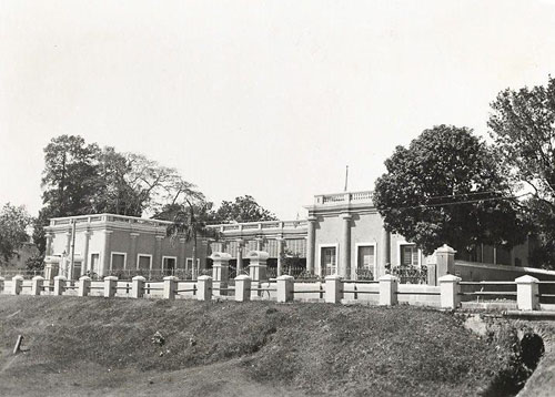
Chandannagar Meseum
The name ‘chandernagore’ is possibly derived from the shape of the bank of the river Ganges which is bent like a half moon (Chand means moon and Nagore implies city in native language Bengali). Chandannagar is well connected to Calcutta by railways, roadways and river and it takes about an hour to reach the place. The people of Chandannagar have excelled in all the fields varying from literature and education to culture, sports and arts all along the history. Chandannagar hosts many tourist places like Museum, Strand, Church, Temples, Rabindra Bhavan, birth places of many celebrities and many other spots some of which are not so well known but nevertheless a treat for the tourists and historians.
Geography
Chandannagar is located at 22.87°N 88.38°E. It has an average elevation of 10 metres (33 ft).
Chandannagar consisted of mainly three parts Khalisani (west),Gondalpara (south) and boro kishanganj (north). presently there are about 30 localities (para) and more than 100 sub-localities.Of them some are Gondalpara, Barasat, Tematha, Hatkhola, Padripara, Barabazar, Bagbazar, Fatokgora, Khalisani, Palpara, Urdibazar, Luxmigunj, Panchanantala, Taldanga, Haridradanga etc. The areas of Dinemardanga, Mahadanga etc. are the newest places in the city and were previously colonies.
The Mankundu area was under G.C Khan (after whom the area is named). Later the place was separated from chandannagar and renamed Mankundu. A railway station was later formed in the Howrah main line. The area is however managed by Chandannagore Municipal Corporation.
The geographical boundary of the city is marked by gateways or ‘gor’s.The G.T.Road runs through the middle of the city. The Delhi road runs marking the western limit of the city. Bajra, Bandhagram etc. are some of the village like areas near the borders of the city.
The city is guarded by Chinsurah in the north, Bhadreshwar in the south, the Hooghly river in the east and Dhaniakhali in the west.
